
How to Access Iceland's Geldingadalir Volcano

Erupting since March 2021, the Geldingadalir and Fagradalsfjall volcanoes in South East Iceland on the Reykjanes peninsula are now being deemed the longest living eruptions of the 21st century. It has since become a major attraction when visiting Iceland, as the eruption site is accessible by the Geldingadalir valley on foot.
This post is written as of Fall 2021, so bear in mind some of the signage may have changed then that pictured below depending on how much time has elapsed. The site still boasts fantastic trails and this can be used as a guide on how to access both volcanoes whether they are erupting or not.
Below we answer the following questions:
How do I get there?
Does it cost anything?
What route do I take?
How long is the full route?
What can I expect from the terrain?
What should I wear?
Are there any facilities?
Are there any restrictions on photos or drones?
A note on safety and hiking in Iceland:
Iceland’s weather is highly changeable, be prepared and be a responsible visitor to the site by following local advice, knowing before you go, packing any provisions you’ll need, taking with you everything that you brought in, wearing the proper gear, and sticking to the marked paths and trails. You’ll notice at the actual site that there are no signs or markers - use your common sense and enjoy the scenery without putting yourself or others in danger. Before you go, we recommend reading over the Icelandic Pledge for the expectations within outdoor spaces.
Travelling to Iceland? Here are our tips on what to know before you go:
Accessibility
Ensure you are physically able to complete a 10 kilometre round trip hike over varying terrain with an elevation of approximately 200 meters before you begin. Take any and all provisions you may need on the hike, especially any medications. Unfortunately, this site isn’t able to be accessed by anyone in a wheelchair, and is not advised for anyone using a cane, crutches or the like.
A reminder that this post is purely a guide based on our experience. It’s more important to follow local advice and updates if there are any.

How do I get there?
The site is located on the Reykjanes peninsula in SouthWest Iceland, approximately an hour’s drive south west of Reykjavik, 30 minutes drive south east of Keflavik and about 10 minutes drive east of Grindavik.
Getting to the volcano, type into your Google Maps Geldingalir (240 Grindavikurbaer), taking the 427 (Suðurstrandarvegur) west. You’ll notice there are two main car parks, one at the main trail head and the other as an overflow car park to the South of the road. The overflow leads you past the main car park and leads, after less than a half a mile down the road, to a wraparound dirt track that doubles you back towards the designated spot. You don’t need a 4WD to access the parking areas for the trail.
Does it cost anything?
The parking areas are on private property, owned by Landeigendafélag Hrauns sf, and require a payment for 1000isk, whether you’re in the main or overflow car park. You can pay by the Parka App - if you don’t have internet access in your vehicle before coming down to the volcano - download this beforehand as it is the only way to pay.

What route do I take?
After parking up, follow the very obvious Geldingadlir trail that heads directly North East from the main car park and Suðurstrandarvegur road.
Very shortly thereafter, you’ll come to a fork in the road. The route has been split into three different viewing areas, and you’ll notice signage for these; marked Route A, B and C.
Route A and B points North towards the actual Geldingardalir and Fargradalsfjall volcanoes, and follows the Gönguleið A/B marked trail, and Route C points South following the Lanihryggur and Narthagi trails, marked as the Gönguleið C trail. We were told that the Route C trail offers a view of the volcano's craters in particular and from a higher elevation.
We chose to follow Route A the whole way. We made this decision because when we visited the site, we had heard that the actual volcano craters didn’t have a lot of activity in the past couple of days, but the volcanic field (which can be fully accessed by Route A) was able to be viewed - and we were definitely not disappointed.

After turning down the Gönguleið A/B marked trail to the North, you’ll come across another fork in the road less than a kilometer thereafter, that splits the Route B (to Fagradalsfjall and marked 1 ½ hour hike and ‘hard’) and Route A (to Geldingardalir, marked 45 minutes and the ‘easier of the two’). We found that these timings were pretty accurate via the Route A.

How long is the full route?
We followed the Route A to view the Geldingalir site, and it took us just under 10 kilometers as a round trip, with a max elevation of 337m (gaining approx. 200m of elevation on the trail). If taking Route A, allow for approximately two hours return, this does not include the time you actually spend at the volcanic site.
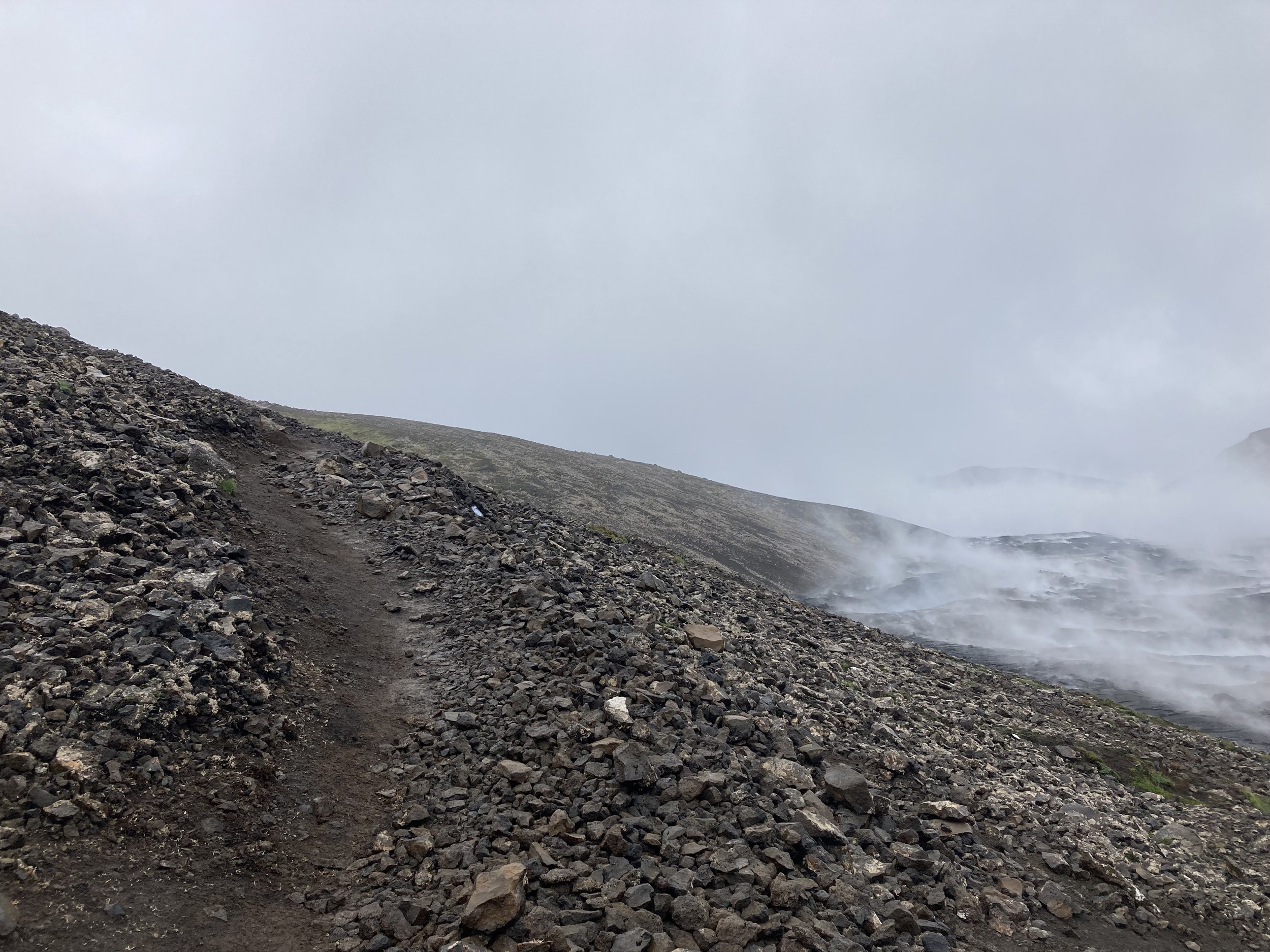
What can I expect from the terrain?
The terrain varies. Before choosing Gönguleið A to follow, the track is similar to other trails; marked, muddy and slightly uneven, although fairly well maintained.
After Gönguleið A, you can expect hard packed black sand, more mud and dirt tracks, sections that are rocky and gravel-like, and sections that have narrower paths through larger rock fields, although no scrambling or climbing over the rocks is necessary. Our suggestion is to wear stable and sturdy hiking shoes or boots, preferably that support the ankles.
What should I wear?
As always in Iceland’s notoriously changeable weather, make sure you wear loads of layers. It may be easy to assume that you’ll get some heat coming off of the site (which is true), but it’s way too exposed to not have your warm weather and rainproof gear. The heat won’t protect you from the rain or wind or the hike up to, and back from, the site.
No matter the season, wear long trousers, hiking boots, a few upper body layers including rainproof gear, gloves and a hat.
Are there any facilities?
There are a few portaloos at the main Landeigendafélag Hrauns sf carpark, but that is it. Don’t go on the trail expecting any facilities, (there aren’t any) so answer any calls of nature before you go, or wait until you’re back down. Like we’ve mentioned above, pack any and all provisions you may need (this includes water, as there are no streams or places to get water on the trail).
Are there any restrictions on photos or drones?
No. Unlike other sites in Iceland that ban drone flying, this site isn’t one of them. Fly at your own risk!

Enjoy and stay safe!
Happy Travels,
Sam

More on Iceland x Adventure Travel…..


One of the best destinations for outdoor adventure travellers, Iceland surprised us in more ways than one. To make the most of your trip, we’ve compiled 8 things that we recommend knowing before you head over including road rules, camping laws and drone bans.